Navy’s U-turn on Exploding Contaminated Buildings
Un Infant Terrible

• • • • • • • • November 2025 • • • • • • • •
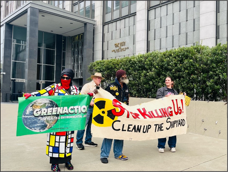
Offering testament to the effectiveness of kicking and screaming like a terrible infant, Navy BRAC (Base Realignment and Closure) Environmental Coordinator Michael Pound quietly announced at the September 22, 2025, meeting of the Hunters Point Shipyard CAC, that explosives will not be used in the demolition of seven radiologically impacted buildings on Parcel G.

- Artist: Paul Gavarni • Date: 1842 - Gift of Eugene L. Garbaty
to Allen Memorial Art Museum, Oberlin, OH
Additionally, the proposed demolition of the ever-increasing number of humongous buildings across the street from Hunters Point hilltop public housing, high-end homes, condos and parks, has been postponed until February 2026. Additionally, the Navy now officially admits the seven buildings slated for demolition are radiologically impacted.
To date, the Navy has issued nothing in print. It will not conduct an environmental impact review as required by the National Environmental Policy Act of 1996 for a demolition project of this magnitude. Indeed, Pound stated publicly that the Navy is not required to conduct an environmental review because the property is undergoing remediation under the CERCLA or Superfund Act.
According to correspondence sent to the “terrible infant” by the Navy Inspector General’s Office in Norfolk, Virginia, on June 15, 2025, at 10:13 am:
“The BRAC process requires Military Departments to analyze the environmental impacts of proposed disposal in compliance with the National Environmental Policy Act of 1969 (NEPA).
Simply stated, the US Navy at the Hunters Point Federal Superfund site cannot parade radioactive and chemical-laden hazardous waste down a residential street into the heart of a neighborhood transit center as a disposal route without, at a minimum, conducting a public participation environmental review.
Palou Avenue is zoned residential, and single-family homes range in value from $690,000 to $1.2 million.

The proposed use of a street zoned residential as a transport route for radioactive hazardous waste generated a strong response from the Coalition for San Francisco Neighborhoods.

Literacy for Environmental Justice Youth lead a Toxic Tour along the unfortified western fence line of the HPNS Federal Superfund site. Parcel G buildings slated for demolition appear in the photo backdrop.

To date, the Navy has issued nothing in print. It will not conduct an environmental impact review as required by the National Environmental Policy Act of 1996 for a demolition project of this magnitude. Indeed, Pound stated publicly that the Navy is not required to conduct an environmental review because the property is undergoing remediation under the CERCLA or Superfund Act.”
The Oxford Dictionary describes the terrible infant as “a person whose unconventional or controversial behavior or ideas shock, embarrass or annoy others.”
Presentation Over Twenty Years Earlier
The May 27, 2004, stenographic minutes of the Hunters Point Shipyard Restoration Advisory Board document the presentation titled Parcel A Is Not Suitable for Transfer.
“Dr. Sumchai concluded her presentation by stating that Parcel A is not suitable for transfer. She cited seven sub-parcels within Parcel A with an ECP classification of 4 to 7.
Also, she said the Navy failed to conduct a radiological investigation of Parcel A’s storm drain and sanitary sewer systems, even though the Historical Radiological Assessment (HRA) established that the storm drains are an impacted area base-wide.
Dr. Sumchai noted black beauty sandblast grit was discovered on two sites at IR-59 JAI. She said radiological analyses were not conducted on either outhouse site.
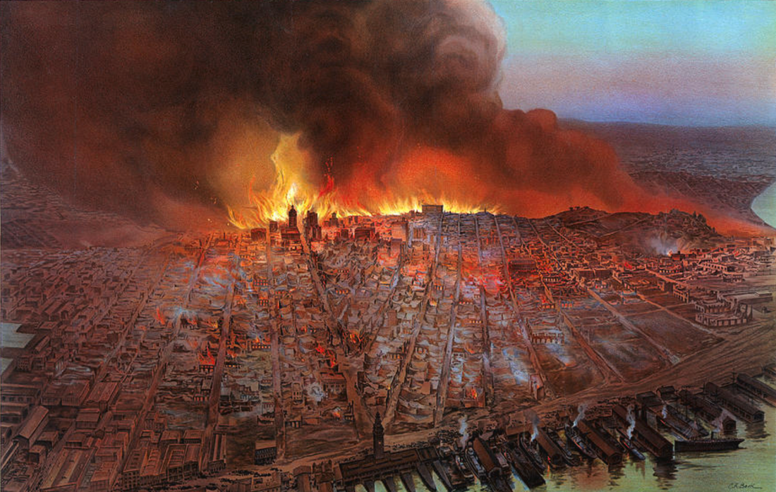
She asserted that IR-59 JAI is essentially a MARSSIM Class I radiologically impacted area. Dr. Sumchai suggested that regulators should consider the documented history of numerous fires that have occurred on Parcel A and that it should be regarded as an imminent risk and threat to human lives and property.
Dr. Sumchai returned to her examination of Parcel A, and specifically the dirt at Parcel A and the levels of ambient chemicals of concern that are present there. She said the interpretation of the human health risk assessment for Parcel A is wrong and that the risk assessment minimized impacts — not because the PRGs (clean up goals) were lowered but because some of the chemicals of concern (arsenic, lead, cobalt, chromium and nickel) that drove the high cancer risk and adverse health effects were removed after being designated Hunters Point Ambient levels (HPAL).
“The BRAC process requires Military Departments to analyze the environmental impacts of proposed disposal in compliance with the National Environmental Policy Act of 1969 (NEPA).”
Dr. Sumchai said a great deal of uncertainty and controversy went into calculating the HPALs. For example, nickel is abundant in the Earth’s crust; however, according to medical research, the highest sources of nickel in the environment come from fuel oil combustion.
Dr. Sumchai suggested high levels of nickel at the Shipyard might result from the 610,000 gallons of fuel oil burned from Operation Crossroads and diesel heavy equipment operations.”

According to the Hunters Point Shipyard (HPS) Historical Radiological Assessment (HRA) Volume II [which I assisted in finalization as Chair of the Radiological Subcommittee of the HPS Restoration Advisory Board], Table 6-6 Phase V Action Summary details all actions taken at every shipyard parcel.
While the HRA is 12 years old, Table 6-6 offers valuable insight into the original degree of radiation contamination existing at Parcels D and G. Remember, Parcel G did not exist when the Final HRA was published in 2004, after the conveyance of Parcel A had begun.

complex at 1000 block of Palou Avenue at intersection with
Oakdale playground and public housing and across the street
from churches and private homes.
Parcel G was “cookie cut” as a separate parcel out of heavily industrialized, chemically contaminated Parcel D, with the intent to site residential development at its northern border along Spear Avenue … across the street from residential Parcel A and less than a mile west via Crisp Road to the 1000 block of Palou Avenue.
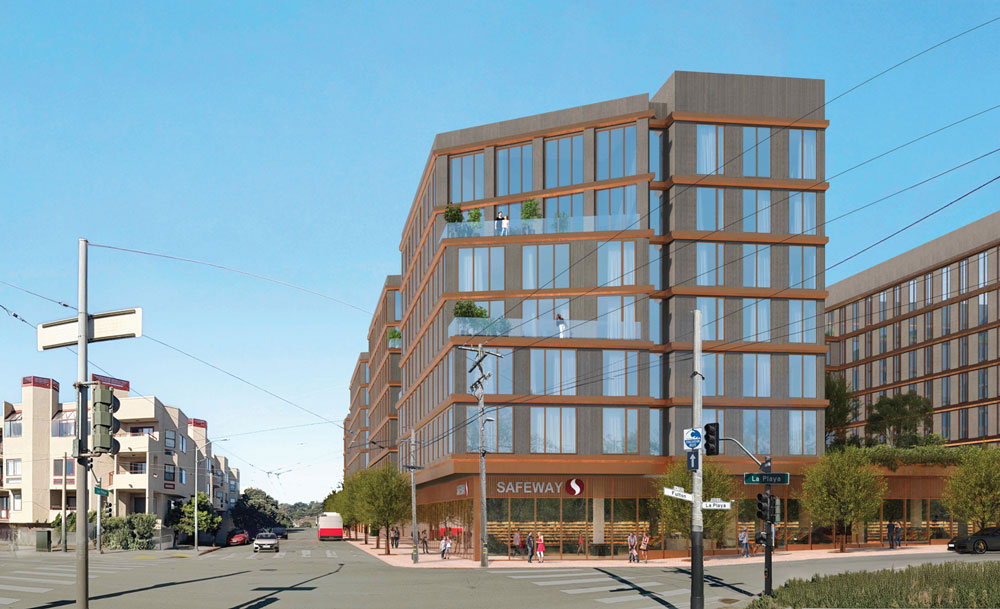
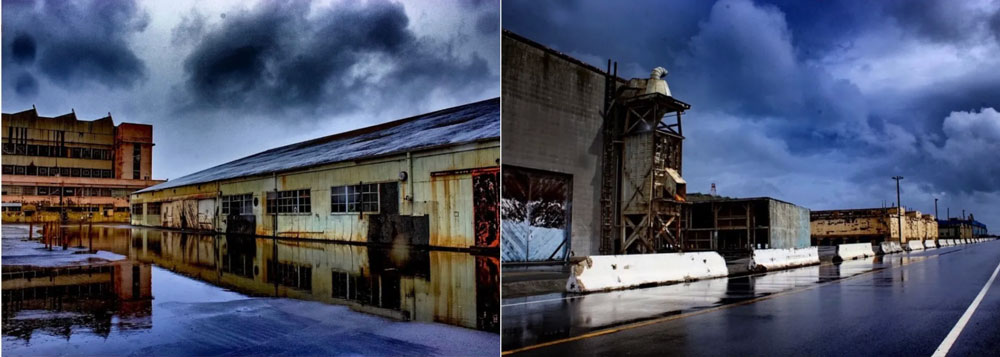
The humungous cluster of buildings on Parcel G, slated for demolition in early 2026, was used as NRDL laboratories, storehouses for weapons, warehouses and technical shops... the most serious degree of radiation contamination.
The humungous cluster of buildings on Parcel G, slated for demolition in early 2026, was used as NRDL laboratories, storehouses for weapons, warehouses and technical shops. Table 6-6 shows that three Class l surveys were completed by 2003. This means the most serious degree of radiation contamination had been confirmed by Class l surveys - qualifying Parcel G as a MARSSIM Class l Radiation contaminated property. This irrefutable fact is admissible in a court of law and published in the Navy’s most credible record - the Historical Radiological Assessment (HRA).

Cesium - 137 was detected at multiple locations, including Buildings 364 and 351A and the 364 trench. Multiple manholes and the entire Gun Mole Pier, where the Hunters Point Gantry Crane sits. Radium - 226 was detected in Building 406, Building 411 and Building 351B. A Class l Survey was conducted at Building 366, with, “contamination in ventilation system and floor drains” reported to RASO…with no follow-up.


Apology Due

According to lawsuits filed in the Federal & Supreme Courts, officers developed brain, thyroid, and lung cancer. They witnessed cancer deaths of their German Shepard service animals. Map, included in the May 21, 2021, privileged communication between Bonner & Bonner Law Firm and Attorneys for Lennar. The Hunters Point Lawsuit recently reached a settlement and awaits a magistrate judge’s approval.
San Francisco City Government owes an apology to shipyard and hilltop residents and workers. People who invested trust, life savings and belief in the fundamental duty of good government to protect its citizens as a first priority.
The risks to life, health, and safety posed by the reckless proposal to demolish radiologically contaminated buildings sited on radiation-contaminated soils next door to homes, food trucks, dog parks, and state workers is the expected consequence of the dirty development of the Hunters Point Naval Shipyard. The handwriting was on the wall when the first homes and condos went up for sale in 2009.
Systems of land use and development have harmed low-income people of color and damaged ecosystems for decades by suppressing self-determination, concentrating hazards, extracting wealth and displacing legacy households through redevelopment … while structural racism and institutional bias create barriers to health and social equity.

buildings along Spear Avenue at the physical
boundary separating federal Superfund
properties from residents on SF properties
was always “in the stars!”
The geographic land-lock facing Hunters Point hilltop residents is further amplified by the abrupt announcement that Lucky’s Supermarket - located at 3rd & Evans in Bayview Plaza - will permanently close after three years of operation on November 01, 2025.
According to the US Bureau of Labor Statistics, about half of all new businesses fail within five years.
A food desert is a geographic area where residents have limited access to affordable and nutritious food. The US Department of Agriculture defines a food desert as a region where the distance from a full-service supermarket or grocery store is more than a mile.
Food deserts are associated with high rates of obesity, chronic diseases, and food insecurity. They are traditionally seen in low-income black and brown neighborhoods, with limited transportation and a lack of vehicles.

The cruel irony of the Lucky Supermarket closure is that it renders both middle to high-income property owners and low-income residents living in federally subsidized public housing on the Hunters Point hilltop vulnerable to the devastating impacts of food apartheid. Another predictable consequence of the dirty development of the Hunters Point Naval Shipyard.
As a direct result of the March 2025 announcement of the Navy proposal to explosively demolish buildings on Parcel G “over the next six months,” twelve UCSF state workers in Building 830, located on the shipyards’ heavily contaminated Parcel E-2 shoreline, were issued layoff notices this month.

UCSF Compound - Building 830/831 lies within 200 feet of the Parcel E-2 industrial landfill. An EPA CERCLA Action conducted in 2012 documented the landfill to contain radionuclides, asbestos, and cancer-causing PCBs.

In 2012 the US Department of Homeland Security conducted an aerial survey of the Bay Area using a Bell 412 helicopter equipped with a radiation detection system at a survey altitude of 300 feet. The Hunters Point Naval Shipyard survey detected gamma radiation emanating from the shoreline and Parcel E-2 landfill in concentrations as high as 7,700 cps. Parcel G region detections averaged 4500 to 5500 cps.

Erin Brokovich Statement

“Thank you for sharing these details. I appreciate your concern and urgency regarding the Navy’s plan to demolish buildings near residential areas. I believe it’s crucial to shed light on the potential health risks associated with the demolition process, especially in communities facing existing health disparities.
“I will review the documents you provided and reach out shortly. In the meantime, please don’t hesitate to provide additional information. We’ll connect soon to talk further about how to support the efforts to protect the Hunters Point Community Biomonitoring and preserve the safety of the community.
“You know I am an American paralegal, consumer advocate and environmental activist - my work focuses on uncovering the truth and standing up against corruption, just like in the real-life chronicles of an intelligent law firm employee who, with a lawyer’s help, exposed the actions of a powerful company.”
Erin Brokovich
Dr. Ahimsa Porter Sumchai is an environmental activist and Community Healer/UCSF Alumni living on the Westside.
November 2025